

The Stengl Lost Pines Biological Station hosts research projects from a broad range range of disciplines on its 581 acres. Read on to learn about some of the recent research being done at our field station.
Studying Calcite Dissolution in Soils
 |
The mineral calcite (calcium carbonate, CaCO3) forms in soils and is the primary host for the nutrient phosphorous in the soils of dry regions. Calcite in soils (also called soil carbonate) is also quite interesting to scientists who study ancient climates because the chemical and isotopic composition of this mineral and its distribution in buried soils provide clues to environments of the past. Soils, however, experience large seasonal variations in climate and environmental conditions such as temperature and water content. What portion of this seasonal variability is recorded in soil carbonates? At SLP, Dan Breecker (professor in the Department of Geological Sciences at UT Austin, https://www.jsg.utexas.edu/breecker-lab) and Tim Gallagher (professor in the Department of Geology at Kent State University, https://www.kent.edu/geology/timothy-gallagher) have installed a controlled and replicated experiment designed to study the formation and dissolution of calcite belowground in soils. The experiment consists of excavated cubic meter pits which were subsequently lined with foam board insulation (bottoms left open) and then backfilled with the original soil (mixed before backfilling). Soil gas wells and temperature and water content sensors were installed in the pits before backfilling. Out of 12 total plots, six have a thin layer in which powdered limestone (calcium carbonate) was mixed (calcite treatment) and six have no calcite (controls). All plots were planted with the native grass sideoats gramma. Rainfall and air temperature are also being recorded. The research involves monitoring the O2 and CO2 concentrations in the gas-filled pore spaces belowground to nondestructively detect calcite formation and dissolution. Respiration belowground, by the roots of plants and by microorganisms, produces CO2 and consumes O2 (at a molar ratio of approximately 1:1). Calcite formation/dissolution produces and consumes CO2 but does not affect O2. Therefore, we can predict what the CO2 ‘should’ be if there was no calcite formation/dissolution by measuring O2. Then we can compare the measured CO2 with this predicted value to assess calcite formation/dissolution. Because CO2 also dissolves in water more readily than O2, the control plots help us separate chemical reactions that involve calcite from reactions between CO2 and water alone.
Environmental Sensing Network
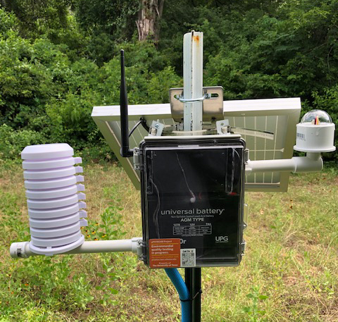 |
Advances in machine learning and remote sensing provide potential for studying life’s diversity and interactions between organisms and their natural environments. Tim Keitt, professor in the Department of Integrative Biology, and his colleagues are interested in leveraging these technologies to understand environmental changes happening in Central Texas as the area is impacted by human population growth and climate change.
To support this goal, Dr. Keitt and his team won a 2020 competitive research award from the Stengl Wyer Endowment. This support will allow them to develop an environmental sensing network at Brackenridge Field Lab and Stengl Lost Pines Biological Station while utilizing the computing resources of the Texas Advanced Computing Center (TACC). The sensors network they propose to develop will monitor the environment by recording sonic, photographic and meteorological data. Sound recording will allow the researchers to continuously sample the vocalizations of animal communities including bats, birds, amphibians, and insects. Photographic cameras will monitor of mammals. Meteorological data will test faunal responses to climate.
Experimental research
Aldo Campagnoni (Rice, grad student) has implemented a long-term study on Texas Bluegrass survivorship in the meadows at SLP.
A sunflower evolution experiment by the Whitney lab (Rice University and U.New Mexico) explores the role of hybridization by comparing long-term evolutionary change in hybridizing and control populations.
Robin Hopkins (Duke University) has studied several aspects of the evolution of the wildflower Phlox drummundii under selection by its pollinators, and conversely how plant species identity and flower color influence pollinator behavior.
Listening to Lightning
Georgia Tech graduate student Jackson McCormick has selected SLP as a site for Very Low Frequency, or VLF, radio receiver, which is used to pick up natural radio emissions from lightening, solar flares, and other phenomena. The surface of the Earth and the ionosphere, a charged layer of our planet’s atmosphere, reflect these radio waves back and forth, creating a waveguide that can propagate low frequency signals for thousands of miles. McCormick’s research group has set up several VLF receivers in the field, each of which has the ability to detect low frequency radio waves from around the world. The receiver constructed at SLP will be used to record data from lightning strikes across the globe in real time, providing information that may be used to increase the reliability of power grids, aviation safety, and the accuracy of weather forecasts. The Stengl field station’s remote and relatively undisturbed location makes it an excellent host for this VLF study.
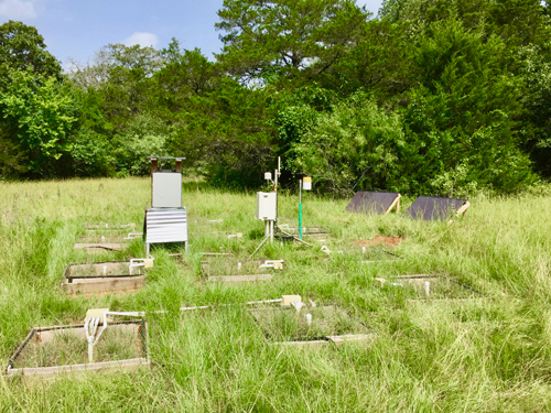
Drought-Net
SLP serves as a monitoring station for Drought-Net, a global collaboration to examine plant community sensitivity to drought. In this part of Texas, droughts are expected to not only become more common but also more severe as a result of climate change. By comparing the plant communities under rainout shelters with those outside them, we can get an idea of how vegetation will change in response to drought. Our experimental sites at both Brackenridge Field Lab and Stengl Lost Pines Biological Station will complement the existing network of 60+ sites across the globe. The initial installation and set up was completed in 2016 by grad student Robby Deans.
Surveys of Plants, Insects, Birds and Soils
Graduate and Undergraduate students have performed multiple surveys across the SLP property. Because the habitats and communities of Stengl are so patchy, mapping the soil, vegetation, and insect communities poses a challenge. Using detailed survey methods, we will be able to account for patchiness caused by differences in land-use history and hydrology. Several surveys were conducted on the original 208 acre tract, and in 2017 the survey efforts have been extended to the new north tract.
Stengl has a unique soil composition that allows plants typically found on the Gulf Coast to persist in the relatively dry Central Texas region. Much of the soil at SLP has a sandy, quick-draining top layer with a water-tight clay pan underneath. The combination of these soil layers allows even sparse rain to be stored underground, where eastern species like the loblolly pine can take advantage of the trapped water. However, the soil at the field station is not uniform. The site not only contains over a dozen soil types, but the depth of the clay pan also varies across in the acreage. These variations have helped create the patchy plant communities found across SLP, with the clay pan often determine where eastern plants can survive. Mapping the changes in soil type and composition at SLP will help us better understand to what degree soil type predicts the community growing in a given patch and which patches may be prone to drying out, increasing risks of crown fires. In 2016, soil samples for the survey were taken at every 100 meters at the intersections of cutline transects by Lauren Trotter. Samples were processed for information on soil and nutrient composition.
In addition to the soil survey, a survey of the understory vegetation at SLP was conducted in 2015 by grad student Emily Rees to map different plant communities and locate areas of high shrub density that could be thinned to reduce the risk of wildfires. Since the North tract had not been acquired at the time of the survey, only the understory of the original Stengl was mapped. However, the Stengl tract survey used the same transect intersections for survey points as the soil mapping survey, allowing us to look for relationships between soil type and plant community structure. At each point, 4 quadrats were established in the cardinal directions, and measures were made of species composition and density at 5 and 10m from the transect intersect point. Standard metrics including stem counts were used to determine density, as well as a novel method that uses hemispherical photography at several heights to calculate the openness of the shrub layer.
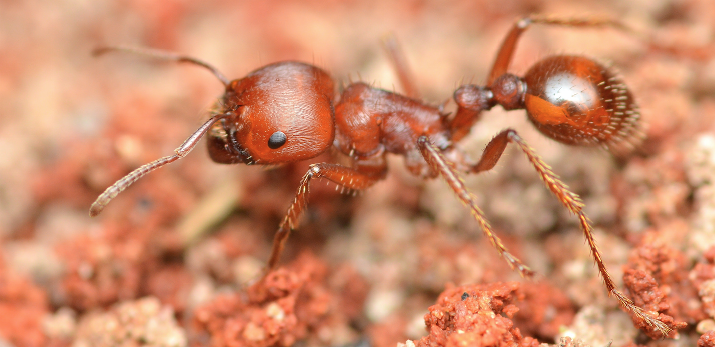
Using information from the understory community and soil maps, an ant survey was performed in 2017 by grad student Robby Deans across 50 sites spanning both the North and Stengl tracts of SLP. These sites were selected to represent the range of soil types and plant communities mapped by previous surveys, and used a broad range of baits and traps to maximize the completeness of the sample. Winkler traps were used to capture small fossorial species, with sugar and protein rich baits set to capture other ants foraging on the ground. Arboreal ants living in shrubs or trees at each point were collected using beat sheets. There was also a five-minute targeted search performed within five meters of each point to capture any species not caught at the other traps or baits. In addition to the ant surveys, Malaise traps were set for two one week periods to catch low-flying insects. Three of these traps were set in an open grassland, with two others in transitional areas between grassland and oak-juniper woodland, and between grassland and pine forest. This comprehensive sampling technique will help our station generate up-to-date species lists, build a reference collection, and provide baseline data for any ant surveys and Malaise trap surveys in the future.
A notable survey of woodpeckers and trees was carried out in 2012 by undergrad Travis Clark. While the impetus was to find associations between canopy trees and woodpecker species, the study provided a detailed distribution of tree species, abundances and size structure that has helped inform habitat distributions.
Experimental research
Aldo Campagnoni (Rice, grad student) has implemented a long-term study on Texas Bluegrass survivorship in the meadows at SLP.
A sunflower evolution experiment by the Whitney lab (Rice University and U.New Mexico) explores the role of hybridization by comparing long-term evolutionary change in hybridizing and control populations.
Robin Hopkins (Duke University) has studied several aspects of the evolution of the wildflower Phlox drummundii under selection by its pollinators, and conversely how plant species identity and flower color influence pollinator behavior.
